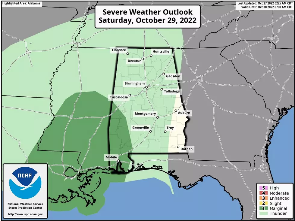
Marginal Risk for Severe Weather Saturday for Southwest Alabama Counties
As you enjoy seasonal temperatures today and tomorrow, the clouds will return Friday night and rain will move across the Yellowhammer State on Saturday. Right now, the rain amount should be around 1 inch.
Also, the Storm Prediction Center has issued a “Marginal Risk” a level 1 out of 5 for possible severe weather in the southwest counties. Some of these counties are in the Townsquare Media coverage area, and as of right now that includes a small portion of Greene County and a large portion of Sumter County.

James Spann, ABC 33/40, and Townsquare Media Tuscaloosa Chief Meteorologist said that a “few storms across Southwest Alabama could produce strong gusty winds, but for the rest of the state is little to no surface-based instability, meaning very little thunder.”
This means the “rain will likely end at some point Sunday morning as a slot of dry air works into the state from the west. A decent part of the state should be dry Sunday afternoon, but some patchy light rain or drizzle is possible across North Alabama Sunday night,” said Spann.

We will closely monitor this weather system over the next few days and bring you the necessary updates.
(Source) Click here to follow the Facebook Page for James Spann.
Clouds: Artwork In The Sky
The Colors Of The Sky
LOOK: The most extreme temperatures in the history of every state
More From Tuscaloosa Thread