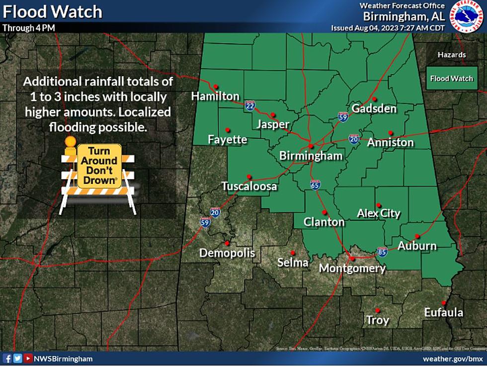
Flood Watch for Sections of Alabama Due to Possible Heavy Rain
As the possibility of flash flooding caused by excessive rainfall continues, the National Weather Service in Birmingham has issued a "Flood Watch" until 4:00 p.m.
According to the National Weather Service in Birmingham, "multiple rounds of showers and thunderstorms are possible through the afternoon. Some areas in the northeast have already received 2 to 4 inches and this band of heavy rain will slide south and west over time. Addition rainfall totals of 1-3 inches with locally higher amounts may result in isolated flash flooding."
The counties that are impacted by this watch include several Townsquare Media coverage areas like Bibb, Fayette, Lamar, Tuscaloosa, and Walker.

The full list of counties under the Flood Watch includes Autauga, Bibb, Chambers, Chilton, Coosa, Elmore, Fayette, Lamar, Lee, Macon, Marion, Russell, Tallapoosa, Tuscaloosa, Blount, Calhoun, Cherokee, Clay, Cleburne, Etowah, Jefferson, Randolph, Shelby, St. Clair, Talladega, Walker, and Winston.
READ MORE: Possible Damaging Winds, Flooding Threat for Alabamians
READ MORE: Heat Index Values on the Rise in Southwest Alabama
THIS is the Most Expensive Airbnb in Alabama, See it for Yourself
Step Inside The Grimsley House Airbnb in Fayette, Alabama
Alabama’s Most Luxurious Airbnb is Like Staying on a Movie Set
Stunning Lay Lake Alabama Airbnb Offers Awesome Pool, Views
Welcome to the Firefly Haus on Smith Lake Alabama
More From Tuscaloosa Thread