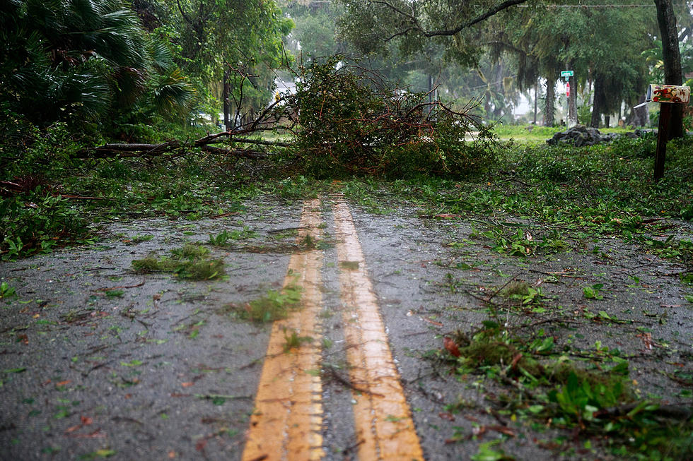
Real-time Updates for Severe Weather in West Alabama Sunday, April 6th
A band of severe storms is expected to impact West Alabama before dawn Sunday morning, and as the National Weather Service in Birmingham hones in on threats, we'll provide real-time weather updates that affect our readership and listening area.
NWS EXTENDS TORNADO WATCH
The first call from the NWS came late Saturday night, when they issued a Tornado Watch for far northwestern Alabama, including Marion and Winston.
As Saturday became Sunday morning, the NWS extended the Watch further into out listening area to include Fayette, Lamar, Pickens and Walker Counties.

THE NATIONAL WEATHER SERVICE HAS EXTENDED TORNADO WATCH 128 TO
INCLUDE THE FOLLOWING AREAS UNTIL 3 AM CDT EARLY THIS MORNING

IN ALABAMA THIS WATCH INCLUDES 4 COUNTIES

IN CENTRAL ALABAMA

FAYETTE               LAMAR                 PICKENS
WALKER

THIS INCLUDES THE CITIES OF ALICEVILLE, CARROLLTON, FAYETTE,
JASPER, SULLIGENT, AND VERNON.

$$

ALC093-133-060800-
/O.CON.KBMX.TO.A.0128.000000T0000Z-250406T0800Z/

TORNADO WATCH 128 REMAINS VALID UNTIL 3 AM CDT EARLY THIS MORNING
FOR THE FOLLOWING AREAS

IN ALABAMA THIS WATCH INCLUDES 2 COUNTIES

IN CENTRAL ALABAMA

MARION                WINSTON

THIS INCLUDES THE CITIES OF HALEYVILLE AND HAMILTON.

$$
NWS ISSUES SEVERE THUNDERSTORM WARNING FOR PICKENS COUNTY
The National Weather Service in Birmingham has issued a

* Severe Thunderstorm Warning for...
  Northwestern Pickens County in west central Alabama...

* Until 215 AM CDT.

* At 125 AM CDT, a severe thunderstorm was located near Bigbee
  Valley, or 8 miles northwest of Pickensville, moving northeast at
  50 mph.

  HAZARD...60 mph wind gusts.

  SOURCE...Radar indicated.

  IMPACT...Expect damage to roofs, siding, and trees.

* Locations impacted include...
  Forest, Macedonia, Ethelsville, Shaw, McShan, and Pickensville.

PRECAUTIONARY/PREPAREDNESS ACTIONS...

Remain alert for a possible tornado! Tornadoes can develop quickly
from severe thunderstorms. If you spot a tornado go at once into the
basement or small central room in a sturdy structure.

For your protection move to an interior room on the lowest floor of a
building.

A Tornado Watch remains in effect until 300 AM CDT for west central
Alabama.

&&
NWS ISSUES TORNADO WARNING FOR PICKENS COUNTY
The National Weather Service in Birmingham has issued a

* Tornado Warning for...
  Northwestern Pickens County in west central Alabama...

* Until 215 AM CDT.

* At 129 AM CDT, a severe thunderstorm capable of producing a tornado
  was located near Bigbee Valley, or 8 miles north of Pickensville,
  moving northeast at 55 mph.

  HAZARD...Tornado.

  SOURCE...Radar indicated rotation.

  IMPACT...Flying debris will be dangerous to those caught without
           shelter. Mobile homes will be damaged or destroyed.
           Damage to roofs, windows, and vehicles will occur.  Tree
           damage is likely.

* Locations impacted include...
  Forest, Macedonia, Ethelsville, and Shaw.

PRECAUTIONARY/PREPAREDNESS ACTIONS...

TAKE COVER NOW! Move to a basement or an interior room on the lowest
floor of a sturdy building. Avoid windows. If you are outdoors, in a
mobile home, or in a vehicle, move to the closest substantial shelter
and protect yourself from flying debris.

&&
NWS ISSUES FLASH FLOOD WARNING IN SEVERAL COUNTIES
The National Weather Service in Birmingham has issued a

* Flash Flood Warning for...
  Marion County in northwestern Alabama...
  Western Winston County in northwestern Alabama...
  Northwestern Fayette County in west central Alabama...
  Lamar County in west central Alabama...

* Until 630 AM CDT.

* At 156 AM CDT, Doppler radar indicated thunderstorms producing
  heavy rain across the warned area. Between 1.5 and 2.5 inches of
  rain have fallen. Additional rainfall amounts of 1 to 2 inches are
  possible in the warned area. Flash flooding is ongoing or expected
  to begin shortly.

  HAZARD...Flash flooding caused by thunderstorms.

  SOURCE...Radar.

  IMPACT...Flash flooding of small creeks and streams, urban
           areas, highways, streets and underpasses as well as
           other poor drainage and low-lying areas.

* Some locations that will experience flash flooding include...
  Hamilton, Winfield, Haleyville, Vernon, Sulligent, Millport, Lynn,
  Guin, Hackleburg, Double Springs, Brilliant, Glen Allen, Kennedy,
  Detroit, Beaverton, Gu-Win, Brinn, Bluff, Weston and Crews.

PRECAUTIONARY/PREPAREDNESS ACTIONS...

Turn around, don't drown when encountering flooded roads. Most flood
deaths occur in vehicles.

Be especially cautious at night when it is harder to recognize the
dangers of flooding.

Be aware of your surroundings and do not drive on flooded roads.

&&
NWS ISSUES SEVERE THUNDERSTORM WARNING FOR FAYETTE AND LAMAR COUNTIES
The National Weather Service in Birmingham has issued a

* Severe Thunderstorm Warning for...
  Southwestern Fayette County in west central Alabama...
  Southeastern Lamar County in west central Alabama...

* Until 300 AM CDT.

* At 157 AM CDT, a severe thunderstorm was located near Ethelsville,
  or 7 miles southwest of Millport, moving northeast at 35 mph.

  HAZARD...60 mph wind gusts and quarter size hail.

  SOURCE...Radar indicated.

  IMPACT...Hail damage to vehicles is expected. Expect wind damage
           to roofs, siding, and trees.

* Locations impacted include...
  Cody, Ashcraft Corner, Stone Wall, Bankston, Richard Arthur Field,
  Millport, Fayette County Public Lake, Fayette, Kennedy, Bevill
  State College Fayette, Crossville, Belk, and Berry.

PRECAUTIONARY/PREPAREDNESS ACTIONS...

For your protection move to an interior room on the lowest floor of a
building.

A Tornado Watch remains in effect until 300 AM CDT for west central
Alabama.

&&
NWS ISSUES SEVERE THUNDERSTORM WARNING IN FAYETTE COUNTY
The National Weather Service in Birmingham has issued a

* Severe Thunderstorm Warning for...
  Central Fayette County in west central Alabama...

* Until 330 AM CDT.

* At 233 AM CDT, a severe thunderstorm was located near Fayette,
  moving northeast at 35 mph.

  HAZARD...60 mph wind gusts and half dollar size hail.

  SOURCE...Radar indicated.

  IMPACT...Hail damage to vehicles is expected. Expect wind damage
           to roofs, siding, and trees.

* Locations impacted include...
  Bevill State College Fayette, Hubbertville, Bazemore, Bankston,
  Fowlers Crossroads, Richard Arthur Field, Berry, Fayette, and Glen
  Allen.

PRECAUTIONARY/PREPAREDNESS ACTIONS...

For your protection move to an interior room on the lowest floor of a
building.

A Tornado Watch remains in effect until 300 AM CDT for central,
northwestern and west central Alabama.
NEW NWS TORNADO WATCH INCLUDES MOST REGIONAL COUNTIES
THE NATIONAL WEATHER SERVICE WILL ALLOW TORNADO WATCH 128 TO
EXPIRE AT 3 AM CDT EARLY THIS MORNING FOR THE FOLLOWING AREAS

IN ALABAMA THIS ALLOWS TO EXPIRE 4 COUNTIES

IN CENTRAL ALABAMA

FAYETTE               LAMAR                 MARION
WINSTON

THIS INCLUDES THE CITIES OF FAYETTE, HALEYVILLE, HAMILTON,
SULLIGENT, AND VERNON.

$$

ALC001-007-009-015-019-021-027-029-037-047-051-055-063-065-073-
091-105-111-115-117-119-121-123-125-061500-
/O.NEW.KBMX.TO.A.0131.250406T0746Z-250406T1500Z/

THE NATIONAL WEATHER SERVICE HAS ISSUED TORNADO WATCH 131 IN
EFFECT UNTIL 10 AM CDT THIS MORNING FOR THE FOLLOWING AREAS

IN ALABAMA THIS WATCH INCLUDES 24 COUNTIES

IN CENTRAL ALABAMA

AUTAUGA               BIBB                  BLOUNT
CALHOUN               CHEROKEE              CHILTON
CLAY                  CLEBURNE              COOSA
DALLAS                ELMORE                ETOWAH
GREENE                HALE                  JEFFERSON
MARENGO               PERRY                 RANDOLPH
SHELBY                ST. CLAIR             SUMTER
TALLADEGA             TALLAPOOSA            TUSCALOOSA

THIS INCLUDES THE CITIES OF ALABASTER, ALEXANDER CITY, ANNISTON,
ASHLAND, BIRMINGHAM, BRENT, CENTRE, CENTREVILLE, CLANTON,
COLUMBIANA, DEMOPOLIS, EUTAW, GADSDEN, GREENSBORO, HEFLIN,
HOOVER, JACKSONVILLE, LINDEN, LINEVILLE, LIVINGSTON, MARION,
MILLBROOK, MOODY, MOUNDVILLE, ONEONTA, PELHAM, PELL CITY,
PRATTVILLE, ROANOKE, ROCKFORD, SELMA, SYLACAUGA, TALLADEGA,
TUSCALOOSA, UNIONTOWN, WETUMPKA, AND YORK.
For ongoing coverage of the threat until it passes, stay connected to the Tuscaloosa Thread.
Top Stories from the Tuscaloosa Thread (3/24 - 3/31)
Gallery Credit: (Stephen Dethrage | Tuscaloosa Thread)
More From Tuscaloosa Thread