Afternoon Storms to Affect Parts of North, West Alabama Monday
Storms moving in from Mississippi have put parts of North and West Alabama at a marginal risk for showers set to begin Monday afternoon.
What to Expect
The National Weather Service in Birmingham said "a front will approach the area from the north with scattered to widespread showers and thunderstorms moving from northwest to southeast today and tonight."
James Spann, ABC 33/40, and Townsquare Media Tuscaloosa Chief Meteorologist, said rain is not expected for everywhere but most communities have a decent chance of seeing some rain.
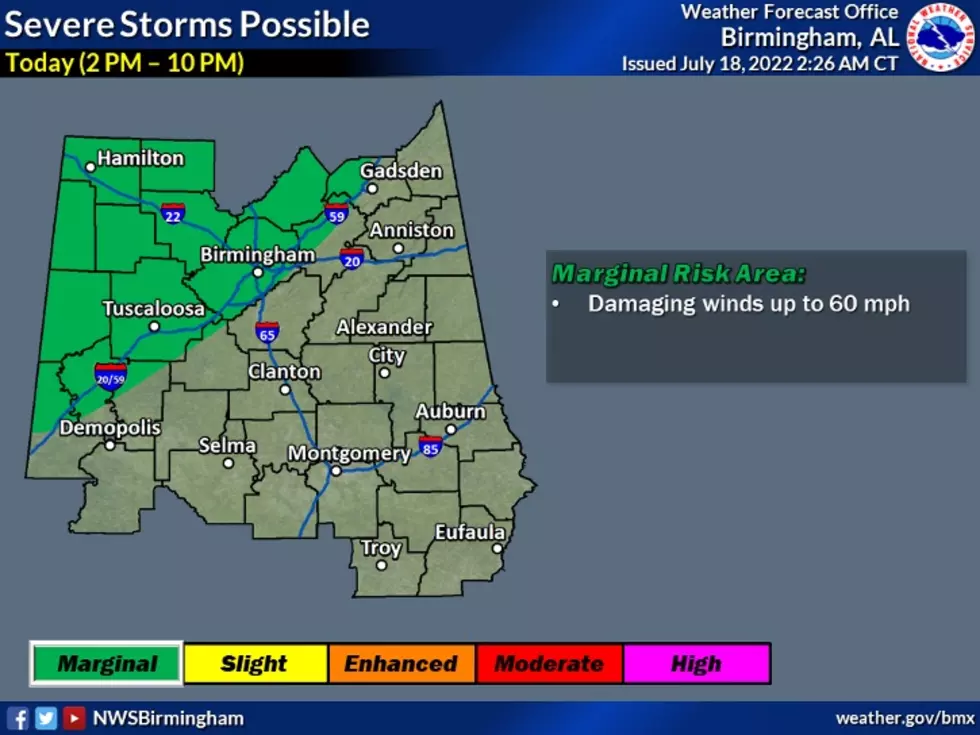
Notes from National Weather Service in Birmingham
- The northwestern half of the area
- 2 PM to 10 PM
- Damaging winds up to 60 mph
In the event of severe weather, we will provide updates for the counties in the Townsquare Media listening area.
Counties we cover
Bibb
Fayette
Greene
Hale
Lamar
Perry
Pickens
Sumter
Tuscaloosa
Walker
(Source) Click here to follow the Facebook Page for James Spann. For more from the National Weather Service Birmingham, click here.
Amazing and Intriguing Weather Folklore
Top Stories from the Tuscaloosa Thread (7/11 - 7/18)
More From Tuscaloosa Thread