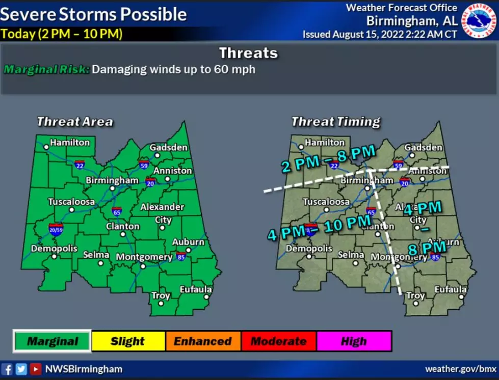
Marginal Risk of Severe Thunderstorms Possible for West, Central Alabama
There is the possibility of strong to severe storms today for West and Central Alabama. As well as several other days this week, so please stay weather aware.

National Weather Service in Birmingham Highlights
Where:
All of Central Alabama
When:
2 pm this afternoon through 10 pm tonight
Threats:
Damaging straight-line winds up to 60mph

James Spann, ABC 33/40, and Townsquare Media Tuscaloosa Chief Meteorologist mention the “chance of a few strong thunderstorms this afternoon ahead of a surface front dropping in from the north. SPC has defined a "marginal risk" (level 1/5) of severe thunderstorms for parts of North/Central Alabama due to the potential for strong winds with the heavier storms.”
Wednesday Outlook
The National Weather Service in Birmingham has also provided a “heads up” about Wednesday noting that “strong to severe storms will be possible once again.”
Where:
Roughly along and south of the Interstate 20 corridor
When:
Wednesday afternoon and evening
Threats:
Damaging straight-line winds up to 60mph
(Source) Click here to follow the Facebook Page for James Spann. For more from the National Weather Service Birmingham, click here.
This Tuscaloosa Condo is Steps Away from Bryant-Denny Stadium
Look Around Deontay Wilder’s Lake Tuscaloosa Stunning Mansion
This Bayou St John Alabama Estate Home Provides Mesmerizing Views
More From Tuscaloosa Thread