Severe Storms Possible Across Portions of West Alabama
Severe Weather Updates
NWS has now canceled this warning at 3:36 p.m.
The National Weather Service in Birmingham has issued a * Tornado Warning for... East central Bibb County in central Alabama... * Until 400 PM CST. * At 325 PM CST, a severe thunderstorm capable of producing a tornado was located near Ashby, or 10 miles east of Centreville, moving northeast at 10 mph. HAZARD...Tornado. SOURCE...Radar indicated rotation. IMPACT...Flying debris will be dangerous to those caught without shelter. Mobile homes will be damaged or destroyed. Damage to roofs, windows, and vehicles will occur. Tree damage is likely.

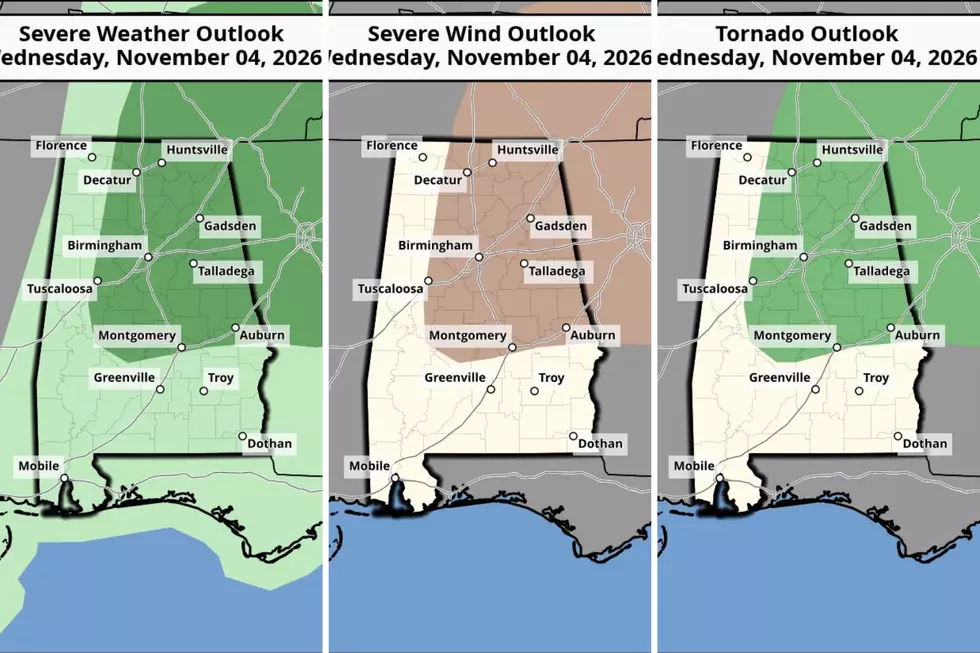
The Storm Prediction Center has issued a Level 1 (out of 5) risk for severe thunderstorms today, Wednesday, November 4, across Alabama, including some counties in the Townsquare Media coverage area.
“Thunderstorms that form along a cold front moving into the state this afternoon,” said James Spann, Alabama Weather Network Chief Meteorologist. “Dynamic support for storms will be weakening and lifting north of the region, so the overall threat is low.”
Rain chances across West Alabama are expected to range from 80% to 90%. Regardless of your county’s designated risk area, be prepared for showers and thunderstorms throughout the day.
West Alabama Counties in the Risk Area
Bibb
Fayette – the far southeastern corner of the county is included
Hale - a good portion of the county is included
Perry
Tuscaloosa – a good portion of the county is included
Walker
Timeline
Active weather is expected between 3 p.m. and midnight.
Possible Impacts
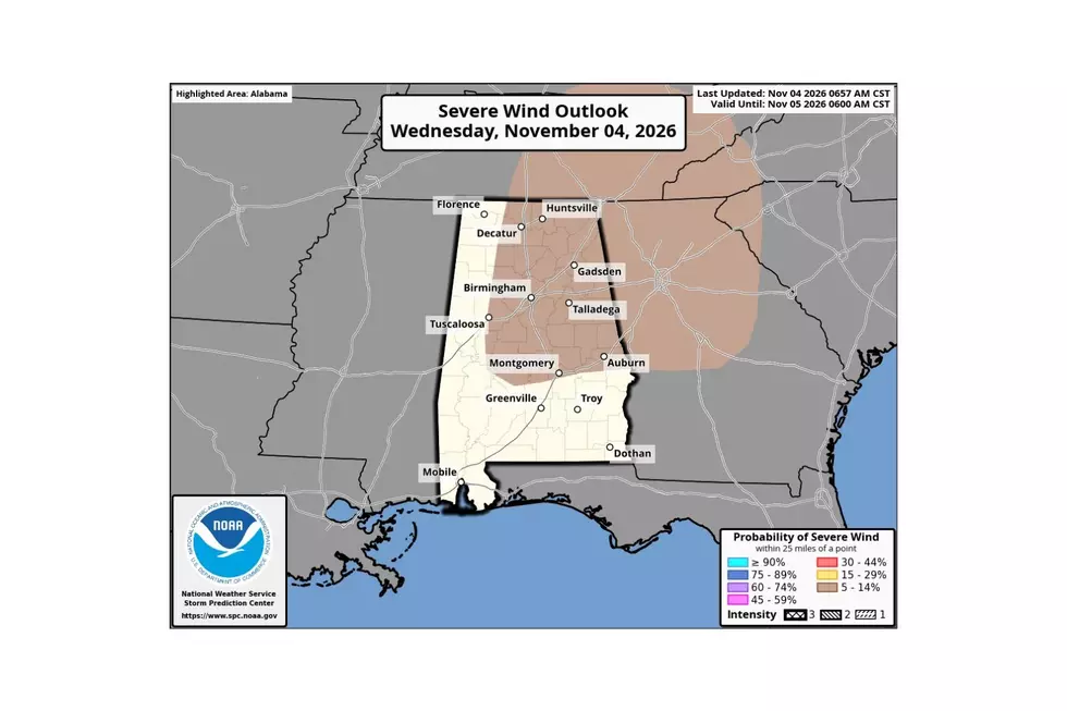
Primary Threat: Damaging Winds with Gusts up to 60 mph
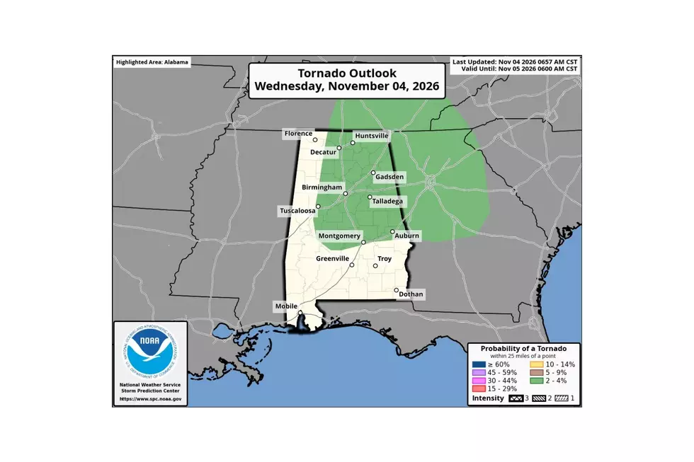
Low Chance Threat: Isolated – Brief Tornadoes
Severe Wind Outlook
Tornado Outlook
Amazing and Intriguing Weather Folklore
Gallery Credit: Mary K
Signs of a Bad Winter According to Weather Folklore
Gallery Credit: Mary K
More From Tuscaloosa Thread