Hurricane Ida to Bring Heavy Rainfall, Isolated Tornadoes to Tuscaloosa, Alabama
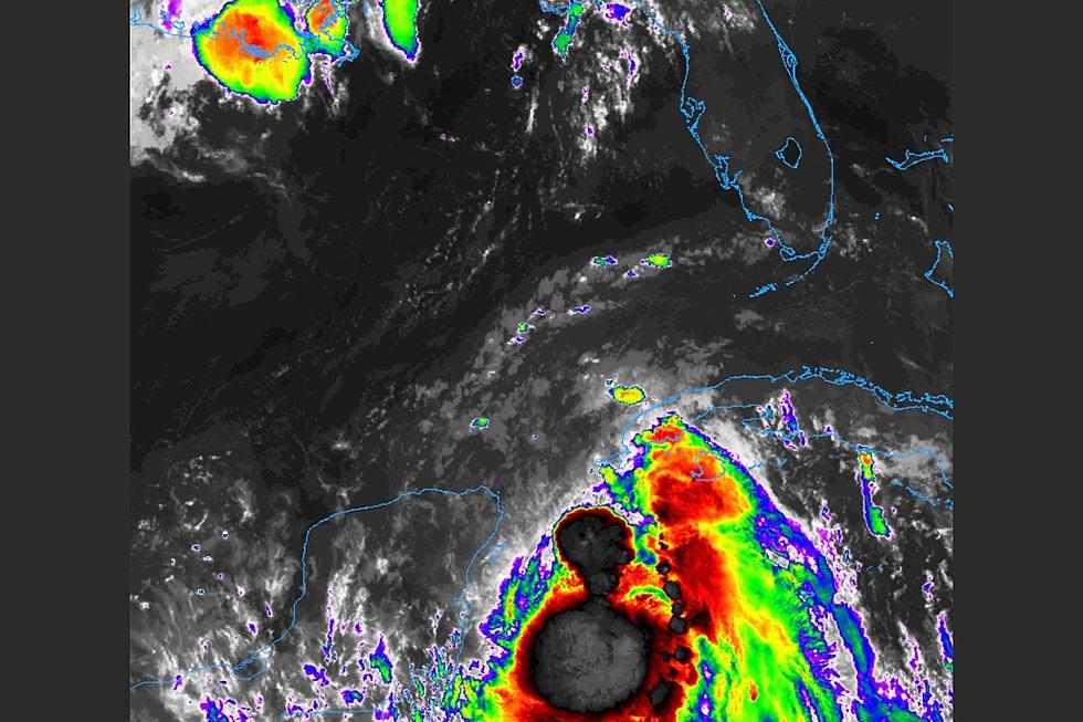
Hurricane Ida is approaching West Alabama after causing devastation in New Orleans and along the Gulf Coast.

Ida made landfall as a category 4 hurricane Sunday and is now tracking towards the east. Primary threats to West Alabama will include heavy rainfall, strong winds and isolated tornadoes.
Townsquare Media Tuscaloosa and ABC 33/40 Chief Meteorologist James Spann says two to four inches of rainfall are possible in Tuscaloosa with higher amounts--approaching six inches--are possible further west near Fayette. A Flash Flood Watch is currently in effect through Tuesday night.
Spann says isolated tornadoes are also possible throughout the day and into Tuesday as Ida moves across the state:
A few isolated, brief tornadoes are possible over most of Alabama later today and tonight. Keep in mind the tornadoes associated with tropical systems are usually short lived, and low topped (literally under the radar). This means they can get down with little or no warning, so be very weather aware. Highest probability of a tornado or two today and tonight is over the southwest part of the state, where SPC has a “slight risk” (level 2/5) defined… there is a “marginal risk” (level 1/5) up for the rest of the state.
Wind gusts of up to 30 to 40 miles an hour are possible over West Alabama, and a Wind Advisory remains in effect through Tuesday evening.
KEEP READING: Tuscaloosa Area Closings and Cancellations
Townsquare Media Tuscaloosa's Operation Storm Watch is brought to you by Safe-T Shelter. Visit their website here to see their selection of residential and commercial safe rooms and storm shelters. To contact a Safe-T Shelter representative, click here to visit their Facebook page.

Check out the latest radar models here:
If a tornado warning is issued in our area, Townsquare Media Tuscaloosa Operation Storm Watch will provide you with live and local team coverage, including wall-to-wall weather with James Spann.
To view the latest weather updates and information, click here.
TIPS: Here’s how you can prepare for power outages
KEEP READING: What to do after a tornado strikes
KEEP READING: Get answers to 51 of the most frequently asked weather questions...
More From Tuscaloosa Thread


