![Heavy Tropical Rainfall Likely in Tuscaloosa, Alabama This Weekend [VIDEO]](http://townsquare.media/site/993/files/2021/06/attachment-tropics-update.jpg?w=980&q=75)
Heavy Tropical Rainfall Likely in Tuscaloosa, Alabama This Weekend [VIDEO]
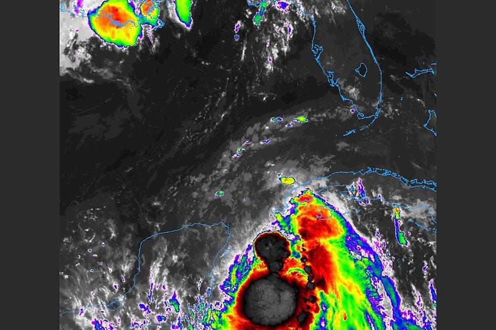
A developing tropical system could bring heavy rainfall to West Alabama this weekend.
Potential Tropical Cyclone Three is currently a minimal tropical storm by the time it makes landfall along the Louisiana Coast, and should the storm strengthen it will be given the name Claudette.

A Flash Flood Watch is in effect for much of the state Saturday and Sunday. ABC 33/40 Chief Meteorologist James Spann describes the potential threats for TS3:
Widespread rain is likely tomorrow and tomorrow night, and the rain will be heavy at times as the tropical low approaches. A flash flood watch is in effect for areas along and south of I-20 (south of a line from Tuscaloosa to Birmingham to Anniston). Rain amounts over the weekend will be in the 2-4 inch range for much of Central Alabama, with 3-5 inches for the southern counties.
A few brief, isolated tornadoes are possible tomorrow and tomorrow night, mainly over the southern half of Alabama. Keep mind these tornadoes associated with a tropical system usually last for only a few minutes, and often warnings can’t be issued. Temperatures tomorrow won’t get out of the 70s due to clouds and rain.
The remnant circulation of the system will move northeast of Alabama Sunday, but it will leave behind a moisture laden airmass. While the rain across Alabama won’t be as widespread Sunday, we still expect scattered to numerous showers and thunderstorms with a high in the low 70s.
Tropical Storm Warnings are active along the Gulf Coast before TS3 makes landfall. Spann detailed threats on the coast in a post to the ABC33/40 Weather Blog:
A tropical storm warning is in effect from Intracoastal City Louisiana to the Okaloosa/Walton County line, including the Alabama Gulf Coast. The main impact on the Central Gulf Coast will come from heavy rain, coastal flooding, and rip currents. The combination of storm surge and the tide will cause normally dry areas near the coast to be flooded by rising waters moving inland from the shoreline. The surge for the Alabama Gulf Coast and Mobile Bay is expected to be 2-3 feet. A few isolated waterspouts and brief tornadoes are possible.
Several outdoor events in the Druid City have been cancelled this weekend; click HERE for a current list of cancellations and delays.
Townsquare Media Tuscaloosa's Operation Storm Watch is brought to you by Safe-T Shelter. Visit their website here to see their selection of residential and commercial safe rooms and storm shelters. To contact a Safe-T Shelter representative, click here to visit their Facebook page.
Check out the latest radar models here:
If a tornado warning is issued in our area, Townsquare Media Tuscaloosa Operation Storm Watch will provide you with live and local team coverage, including wall-to-wall weather with James Spann.
To view the latest weather updates and information, click here.
TIPS: Here’s how you can prepare for power outages
KEEP READING: What to do after a tornado strikes
KEEP READING: Get answers to 51 of the most frequently asked weather questions...
More From Tuscaloosa Thread