Real-Time West Alabama Weather Updates for Saturday, December 28th
Townsquare Media and the Tuscaloosa Thread are providing live severe weather updates to help keep readers aware of threats as they develop today, December 28th.
Storms with the risk of becoming severe will move west-to-east over much of Alabama including some that are expected to arrive overnight and into Sunday morning.

The line of fast-moving storms has produced Particularly Dangerous Situation (PDS) Tornado Watches in Louisiana and Mississippi and is expected
This space will primarily be used to share information about watches and warnings as they are issued in our radio listening area.
WINFIELD NOAA WEATHER RADIO KNOCKED OFF THE AIR
The Winfield NOAA Weather Radio transmitter, broadcasting on a
frequency of 162.525 MHz, is off the air, due to power failure.

We are working with technicians to get it back up and running as
soon as possible. In the meantime, please refer to local media and
commercial radio for the latest severe weather information. Backup
NOAA Weather Radio transmitters are:

Tuscaloosa, broadcasting on a frequency of 162.400 MHz,
Aberdeen, MS, broadcasting on a frequency of 162.450 MHz, and
Birmingham, broadcasting on a frequency of 162.550 MHz.

Keep in mind that not all backup transmitters will tone for your
specific county, so please stay weather aware during the outage.

Thank you for your patience. We apologize for any inconvenience this
outage may cause.
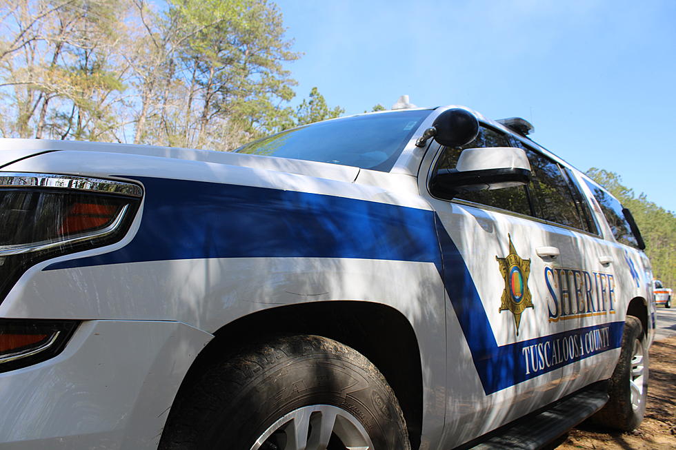
SEVERE THUNDERSTORM WARNING ISSUED FOR TUSCALOOSA COUNTY
The National Weather Service in Birmingham has issued a

* Severe Thunderstorm Warning for...
  Tuscaloosa County in west central Alabama...

* Until 1115 PM CST.

* At 1000 PM CST, severe thunderstorms were located along a line
  extending from near Fayette to near Boligee, moving east at 60 mph.

  HAZARD...70 mph wind gusts.

  SOURCE...Radar indicated.

  IMPACT...Expect considerable tree damage. Damage is likely to
           mobile homes, roofs, and outbuildings.

* Locations impacted include...
  Tuscaloosa, Northport, Holt, Lake View, Brookwood, Coaling, Vance,
  Coker, Samantha, McFarland Mall, Lake Lurleen State Park,
  Tuscaloosa Amphitheater, Tuscaloosa Regional Airport, Lake
  Wildwood, Mercedes Benz Of Alabama, Binion Creek Landing, Abernant,
  Shelton State Community College, Bryant Denny Stadium, and
  University Mall.

PRECAUTIONARY/PREPAREDNESS ACTIONS...

Remain alert for a possible tornado! Tornadoes can develop quickly
from severe thunderstorms. If you spot a tornado go at once into the
basement or small central room in a sturdy structure.

For your protection move to an interior room on the lowest floor of a
building.

A Tornado Watch remains in effect until 400 AM CST for central and
west central Alabama.

&&

LAT...LON 3352 8767 3361 8763 3359 8732 3352 8732
      3350 8726 3348 8730 3349 8733 3346 8734
      3339 8723 3337 8723 3334 8718 3331 8716
      3328 8707 3319 8720 3313 8720 3313 8728
      3309 8731 3301 8732 3302 8783 3352 8784
TIME...MOT...LOC 0400Z 271DEG 34KT 3367 8778 3274 8799

TORNADO...POSSIBLE
THUNDERSTORM DAMAGE THREAT...CONSIDERABLE
HAIL THREAT...RADAR INDICATED
MAX HAIL SIZE...<.75 IN
WIND THREAT...RADAR INDICATED
MAX WIND GUST...70 MPH
TORNADO WARNING ISSUED FOR MARION COUNTY
The National Weather Service in Birmingham has issued a

* Tornado Warning for...
  Marion County in northwestern Alabama...

* Until 1030 PM CST.

* At 948 PM CST, severe thunderstorms capable of producing a tornado
  were located along a line extending from near Detroit to near
  Gu-Win, moving northeast at 60 mph.

  HAZARD...Tornado.

  SOURCE...Radar indicated rotation.

  IMPACT...Flying debris will be dangerous to those caught without
           shelter. Mobile homes will be damaged or destroyed.
           Damage to roofs, windows, and vehicles will occur.  Tree
           damage is likely.

* Locations impacted include...
  Hamilton, Winfield, Haleyville, Guin, Hackleburg, Brilliant, Gu-
  Win, Brinn, Weston, Lake Buttahatchee, Bear Creek, Twin, Tucker,
  Tessner, Pearces Mill, Rankin Fite Airport, Upper Bear Creek
  Reservoir, Byrd, Bexar, and Pigeye.

PRECAUTIONARY/PREPAREDNESS ACTIONS...

TAKE COVER NOW! Move to a basement or an interior room on the lowest
floor of a sturdy building. Avoid windows. If you are outdoors, in a
mobile home, or in a vehicle, move to the closest substantial shelter
and protect yourself from flying debris.

&&

LAT...LON 3431 8763 3410 8764 3392 8782 3392 8795
      3402 8795 3402 8799 3405 8799 3406 8821
      3414 8820 3432 8809
TIME...MOT...LOC 0348Z 213DEG 51KT 3410 8817 3390 8793

TORNADO...RADAR INDICATED
MAX HAIL SIZE...<.75 IN
SEVERE THUNDERSTORM WARNING ISSUED FOR MARENGO & HALE COUNTY
The National Weather Service in Birmingham has issued a

* Severe Thunderstorm Warning for...
  Marengo County in southwestern Alabama...
  Hale County in west central Alabama...

* Until 1100 PM CST.

* At 942 PM CST, severe thunderstorms were located along a line
  extending from near Panola to near Butler, moving east at 40 mph.

  HAZARD...70 mph wind gusts.

  SOURCE...Radar indicated.

  IMPACT...Expect considerable tree damage. Damage is likely to
           mobile homes, roofs, and outbuildings.

* Locations impacted include...
  Demopolis, Greensboro, Linden, Uniontown, Jefferson, Moundville,
  Thomaston, Akron, Sweet Water, Newbern, Myrtlewood, Faunsdale,
  Dayton, Nanafalia, Consul, Magnolia, Sawyerville, Wayne, Miller,
  and Vineland.

PRECAUTIONARY/PREPAREDNESS ACTIONS...

For your protection move to an interior room on the lowest floor of a
building.

Intense thunderstorm lines can produce brief tornadoes and widespread
significant wind damage. Although a tornado is not immediately
likely, it is best to move to an interior room on the lowest floor of
a building. These storms may cause serious injury and significant
property damage.

A Tornado Watch remains in effect until 400 AM CST for central, south
central, southwestern and west central Alabama.

&&

LAT...LON 3228 8802 3231 8795 3243 8804 3259 8774
      3262 8781 3275 8781 3276 8787 3289 8782
      3301 8771 3300 8742 3283 8742 3265 8753
      3227 8747 3213 8752 3213 8762 3199 8767
      3200 8811
TIME...MOT...LOC 0342Z 267DEG 34KT 3294 8821 3204 8819

THUNDERSTORM DAMAGE THREAT...CONSIDERABLE
HAIL THREAT...RADAR INDICATED
MAX HAIL SIZE...<.75 IN
WIND THREAT...RADAR INDICATED
MAX WIND GUST...70 MPH
TORNADO WARNING ISSUED FOR LAMAR COUNTY
The National Weather Service in Birmingham has issued a

* Tornado Warning for...
  Lamar County in west central Alabama...

* Until 1000 PM CST.

* At 927 PM CST, a severe thunderstorm capable of producing a tornado
  was located near Bedford, or near Vernon, moving northeast at 70
  mph.

  HAZARD...Tornado.

  SOURCE...Radar indicated rotation.

  IMPACT...Flying debris will be dangerous to those caught without
           shelter. Mobile homes will be damaged or destroyed.
           Damage to roofs, windows, and vehicles will occur.  Tree
           damage is likely.

* Locations impacted include...
  Vernon, Sulligent, Detroit, Beaverton, Lamar County Airport, Crews,
  Bedford, Henson Springs, Star, Pine Springs, Hightogy, and Lamar
  County Public Lake.

PRECAUTIONARY/PREPAREDNESS ACTIONS...

TAKE COVER NOW! Move to a basement or an interior room on the lowest
floor of a sturdy building. Avoid windows. If you are outdoors, in a
mobile home, or in a vehicle, move to the closest substantial shelter
and protect yourself from flying debris.

&&

LAT...LON 3395 8822 3406 8814 3405 8799 3402 8799
      3402 8795 3386 8795 3360 8817 3365 8826
TIME...MOT...LOC 0327Z 212DEG 60KT 3372 8821

TORNADO...RADAR INDICATED
MAX HAIL SIZE...<.75 IN
SEVERE THUNDERSTORM WARNING ISSUED FOR MARION & FAYETTE COUNTIES
The National Weather Service in Birmingham has issued a

* Severe Thunderstorm Warning for...
  Marion County in northwestern Alabama...
  Fayette County in west central Alabama...

* Until 1045 PM CST.

* At 928 PM CST, severe thunderstorms were located along a line
  extending from near Mantachie to near Millport, moving northeast at
  55 mph.

  HAZARD...70 mph wind gusts.

  SOURCE...Radar indicated.

  IMPACT...Expect considerable tree damage. Damage is likely to
           mobile homes, roofs, and outbuildings.

* Locations impacted include...
  Hamilton, Winfield, Fayette, Haleyville, Guin, Hackleburg, Berry,
  Brilliant, Glen Allen, Belk, Gu-
  Win, Bankston, Weston, Bluff, Boley Springs, Brinn, Lake
  Buttahatchee, Bear Creek, Twin, and Tucker.

PRECAUTIONARY/PREPAREDNESS ACTIONS...

For your protection move to an interior room on the lowest floor of a
building.

Intense thunderstorm lines can produce brief tornadoes and widespread
significant wind damage. Although a tornado is not immediately
likely, it is best to move to an interior room on the lowest floor of
a building. These storms may cause serious injury and significant
property damage.

A Tornado Watch remains in effect until 400 AM CST for central,
northwestern and west central Alabama.

&&

LAT...LON 3430 8763 3387 8764 3387 8753 3369 8753
      3369 8742 3360 8743 3361 8763 3358 8763
      3358 8767 3353 8767 3352 8768 3353 8795
      3402 8795 3402 8799 3405 8799 3406 8821
      3432 8817
TIME...MOT...LOC 0328Z 234DEG 47KT 3435 8847 3361 8813

THUNDERSTORM DAMAGE THREAT...CONSIDERABLE
HAIL THREAT...RADAR INDICATED
MAX HAIL SIZE...<.75 IN
WIND THREAT...RADAR INDICATED
MAX WIND GUST...70 MPH
SEVERE THUNDERSTORM WARNING ISSUED FOR LAMAR COUNTY
The National Weather Service in Birmingham has issued a

* Severe Thunderstorm Warning for...
  Lamar County in west central Alabama...

* Until 1000 PM CST.

* At 906 PM CST, severe thunderstorms were located along a line
  extending from Verona to near Bent Oak, moving northeast at 55 mph.

  HAZARD...60 mph wind gusts.

  SOURCE...Radar indicated.

  IMPACT...Expect damage to roofs, siding, and trees.

* Locations impacted include...
  Vernon, Sulligent, Millport, Kennedy, Detroit, Beaverton, Blooming
  Grove, Lamar County Airport, Crews, Bedford, Crossville, Cody,
  Henson Springs, Lamar County Public Lake, Star, Pine Springs,
  Hightogy, and Melborne.

PRECAUTIONARY/PREPAREDNESS ACTIONS...

This is a DANGEROUS SITUATION. These storms are producing widespread
wind damage across Central Mississippi. SEEK SHELTER NOW inside a
sturdy structure and stay away from windows! Intense thunderstorm
lines can produce brief tornadoes and widespread significant wind
damage. Although a tornado is not immediately likely, it is best to
move to an interior room on the lowest floor of a building. These
storms may cause serious injury and significant property damage.

A Tornado Watch remains in effect until 400 AM CST for northwestern
and west central Alabama.

&&

LAT...LON 3406 8821 3405 8799 3402 8799 3402 8795
      3353 8795 3354 8827
TIME...MOT...LOC 0306Z 237DEG 46KT 3418 8869 3344 8846

HAIL THREAT...RADAR INDICATED
MAX HAIL SIZE...<.75 IN
WIND THREAT...RADAR INDICATED
MAX WIND GUST...60 MPH
SEVERE THUNDERSTORM WARNING ISSUED FOR PICKENS, GREENE AND SUMTER COUNTIES
The National Weather Service in Birmingham has issued a

* Severe Thunderstorm Warning for...
  Pickens County in west central Alabama...
  Greene County in west central Alabama...
  Sumter County in west central Alabama...

* Until 1015 PM CST.

* At 855 PM CST, severe thunderstorms were located along a line
  extending from near Crawford to near Meridian, moving east at 45
  mph.

  HAZARD...70 mph wind gusts.

  SOURCE...Radar indicated.

  IMPACT...Expect considerable tree damage. Damage is likely to
           mobile homes, roofs, and outbuildings.

* Locations impacted include...
  Demopolis, Livingston, Eutaw, York, Aliceville, Gordo, Reform,
  Carrollton, Pickensville, Cuba, Forkland, Boligee, Union,
  Gainesville, Epes, Ethelsville, Emelle, Memphis, McMullen, and
  Panola.

PRECAUTIONARY/PREPAREDNESS ACTIONS...

This is a DANGEROUS SITUATION. These storms are producing widespread
wind damage across Central Mississippi. SEEK SHELTER NOW inside a
sturdy structure and stay away from windows! Intense thunderstorm
lines can produce brief tornadoes and widespread significant wind
damage. Although a tornado is not immediately likely, it is best to
move to an interior room on the lowest floor of a building. These
storms may cause serious injury and significant property damage.

A Tornado Watch remains in effect until 400 AM CST for southwestern
and west central Alabama.

&&

LAT...LON 3353 8827 3352 8784 3302 8783 3302 8771
      3299 8771 3286 8783 3280 8782 3276 8787
      3275 8781 3271 8783 3265 8774 3262 8781
      3259 8774 3252 8782 3254 8782 3243 8804
      3238 8804 3231 8793 3231 8842
TIME...MOT...LOC 0255Z 269DEG 37KT 3327 8866 3236 8869

THUNDERSTORM DAMAGE THREAT...CONSIDERABLE
HAIL THREAT...RADAR INDICATED
MAX HAIL SIZE...<.75 IN
WIND THREAT...RADAR INDICATED
MAX WIND GUST...70 MPH
TORNADO WATCH ISSUED FOR 22 COUNTIES, INCLUDING TUSCALOOSA

THE NATIONAL WEATHER SERVICE HAS ISSUED TORNADO WATCH 722 IN EFFECT UNTIL 4 AM CST SUNDAY FOR THE FOLLOWING AREAS IN ALABAMA
THIS WATCH INCLUDES 22 COUNTIES IN CENTRAL ALABAMA: AUTAUGA BIBB BLOUNT CHILTON DALLAS FAYETTE GREENE HALE JEFFERSON LAMAR LOWNDES MARENGO MARION PERRY PICKENS SHELBY ST. CLAIR SUMTER TALLADEGA TUSCALOOSA WALKER WINSTON
THIS INCLUDES THE CITIES OF ALABASTER, ALICEVILLE, BIRMINGHAM, BRENT, CARROLLTON, CENTREVILLE, CLANTON, COLUMBIANA, DEMOPOLIS, EUTAW, FAYETTE, FORT DEPOSIT, GREENSBORO, HALEYVILLE, HAMILTON, HOOVER, JASPER, LINDEN, LIVINGSTON, LOWNDESBORO, MARION, MOODY, MOUNDVILLE, ONEONTA, PELHAM, PELL CITY, PRATTVILLE, SELMA, SULLIGENT, SYLACAUGA, TALLADEGA, TUSCALOOSA, UNIONTOWN, VERNON, AND YORK.
STORM SHELTERS OPEN IN TUSCALOOSA
Top Stories from the Tuscaloosa Thread (12/16 - 12/23)
Gallery Credit: (Stephen Dethrage | Tuscaloosa Thread)
More From Tuscaloosa Thread