Alabamians Be Weather Aware: Possible Severe Weather on Saturday
We are monitoring a system developing to our west. This weather setup could cause a severe weather threat for portions of Texas, Oklahoma, Louisiana, and Mississippi on Friday afternoon and night. The main threats for those areas are isolated tornadoes, damaging wind gusts, hail, and localized flooding. This system will continue to move towards the east towards Alabama.

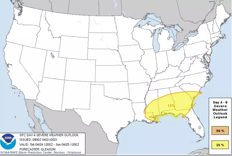
This potential fast-moving system could deliver two different rounds of rain, heavy rain, and thunderstorms to our coverage areas starting Saturday at Midnight going into the Saturday evening.
James Spann, ABC 33/40, and Townsquare Media Tuscaloosa Chief Meteorologist notes that the Storm Prediction Center “ maintains a risk of severe thunderstorms for Central and South Alabama Saturday... for areas along and south of I-20 (Tuscaloosa to Birmingham to Anniston).”
These two rounds could take place in the morning with the possibility of isolated tornadoes and the other in the afternoon with concerns of hail and straight-line winds. James Spann commented that the “Rain amounts of 1-2 inches are likely, and some flooding issues could develop during the day where heavier thunderstorms form.”
(Source) Click here to follow the Facebook Page for James Spann.
PHOTOS: Moundville Tornado Aftermath
PHOTOS: Centreville Residents Recover After Thursday's Tornado
PHOTOS: Brent, Alabama Storm Damage
More From Tuscaloosa Thread


