Severe Storms, Brief Tornadoes Possible in Tuscaloosa Thursday
Severe thunderstorms are possible across West Alabama Thursday afternoon and through the evening hours.
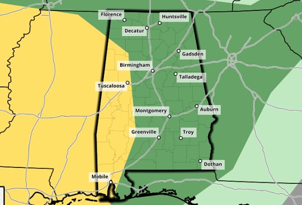
The National Weather Service in Birmingham has placed areas south of Interstate 22 and Interstate 20 under a marginal risk for severe storms. Damaging winds of up to 60 miles an hour are possible as well as isolated tornadoes.
9/23, 5:35a: The coverage of showers will increase later today, becoming widespread by tomorrow. There will be...
Posted by US National Weather Service Birmingham Alabama on Wednesday, September 23, 2020
The latest forecast suggests storms could begin around 1 p.m. Thursday and continue through 10 p.m. Storms could also bring heavy rainfall to our area, with Tuscaloosa to see two to three inches of rain as the remnants of Tropical Storm Beta move inland.
9/22, 11 AM: #Beta has weakened into a Tropical Depression with max winds of 35 mph. We'll begin to see widespread rain...
Posted by US National Weather Service Birmingham Alabama on Tuesday, September 22, 2020
For a more in-depth look at the forecast, watch the latest Weather Xtreme video from Townsquare Media Tuscaloosa and ABC 33/40 Chief Meteorologist James Spann below.
We will continue to monitor the forecast and bring you updates as they become available.

Things To Have Before It Rains
More From Tuscaloosa Thread