Ida Now a Tropical Depression, Tornadoes Still Possible in Alabama Through Tuesday
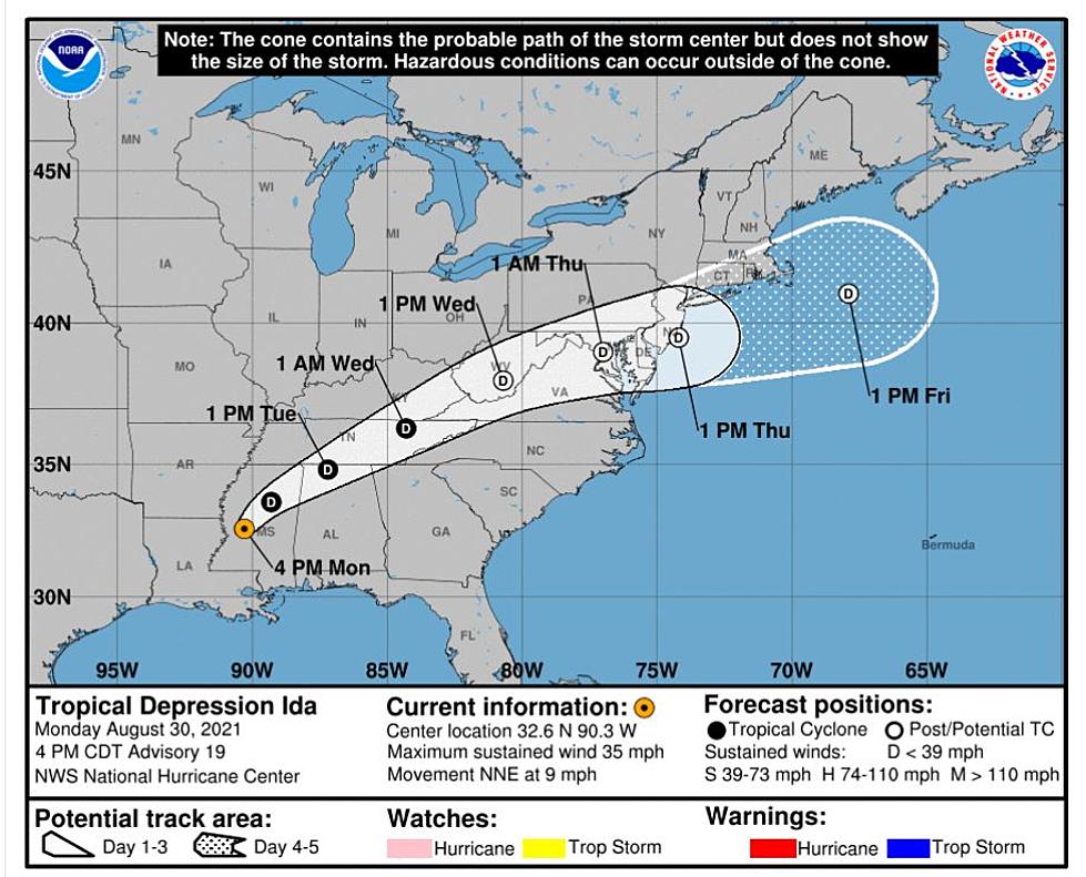
Ida has been downgraded to a tropical depression as it made its journey through Mississippi. However, the relatively slow movement of the system still gives our coverage area the potential for tornadoes, wind gusts, heavy rain, and flooding is still possible through Tuesday. Please stay weather aware this evening, overnight hours, and tomorrow morning.

The National Weather Service in Birmingham reports that they “observed a few rain bands with embedded rotation that have produced at least one tornado in Pike County.” Here is a video from the Facebook page for James Spann.
Here is an overview of what to expect for the duration of this system from the National Weather Service in Birmingham.
Tornado:
- What: Potential for a few tornadoes
- Where: All of Central Alabama
- When: Through Tuesday
Wind:
- What: Potential for sustained winds up to 25 mph with gusts up to 40 mph, occurring with and outside of rain bands
- Where: Much of Central Alabama
- When: Through Tuesday
Flooding:
- What: Additional rainfall totaling a few inches and instances of flooding
- Where: Much of Central Alabama
- When: Through Tuesday
- Minor flooding is forecast along portions of the Tombigbee and Sucarnoochee Rivers, Tuesday through the end of the week
(Source) Click here for more from James Spann. Click here for more from the National Weather Service.
Townsquare Media Tuscaloosa's Operation Storm Watch is brought to you by Safe-T Shelter. Visit their website here to see their selection of residential and commercial safe rooms and storm shelters. To contact a Safe-T Shelter representative, click here to visit their Facebook page.
Check out the latest radar models here:
If a tornado warning is issued in our area, Townsquare Media Tuscaloosa Operation Storm Watch will provide you with live and local team coverage, including wall-to-wall weather with James Spann.
To view the latest weather updates and information, click here.
TIPS: Here’s how you can prepare for power outages
KEEP READING: What to do after a tornado strikes
KEEP READING: Get answers to 51 of the most frequently asked weather questions...
More From Tuscaloosa Thread