Active Weather Expected Starting on Wednesday for Central Alabama
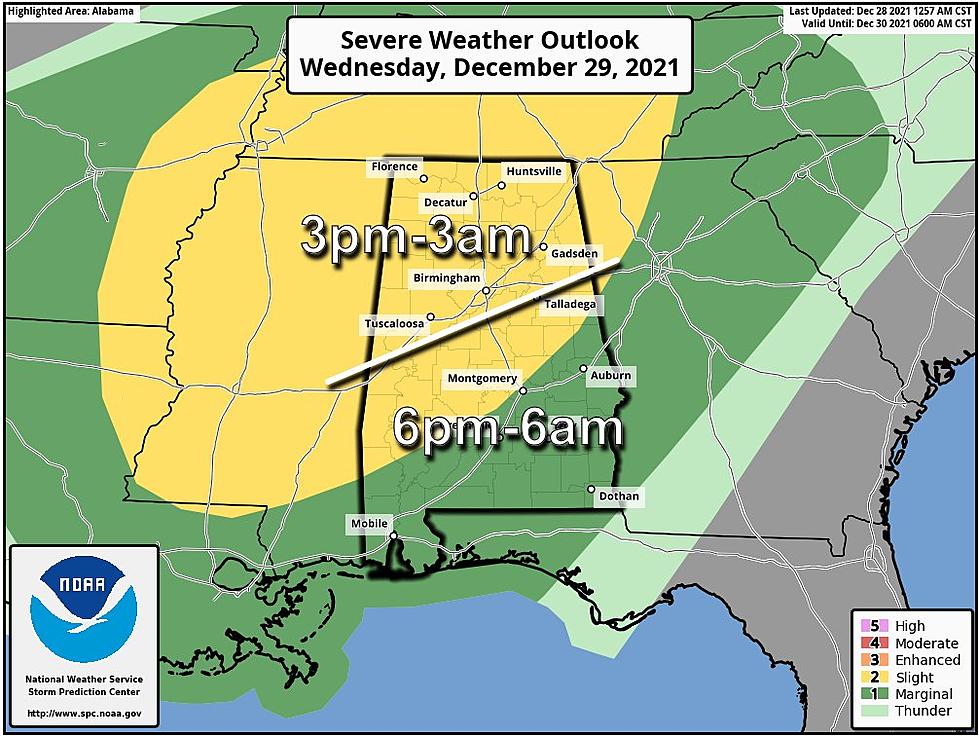
We are monitoring the possibility for severe weather that will start on Wednesday that will continue until early Thursday morning. The Storm Prediction Center has issued a "slight risk" which is level 2 out of 5 for areas north of a line from Grove Hill to Montgomery to Roanoke. For the rest of the state which is south of that line, there is a “marginal risk" which is a level 1 out of 5.

Since this current severe weather threat is happening during typical sleeping hours, please make sure you have multiple ways to receive weather information and alerts. Also, now is a great time to review your severe weather plan and notify family and friends who don’t typically keep up with the weather.
Projected Broad Timeline
Wednesday at 3 p.m. going until Thursday at 3 a.m.
Threat Outlook
Damaging winds up to 60 mph
A tornado is possible.
James Spann, ABC 33/40, and Townsquare Media Tuscaloosa Chief Meteorologist discussed the timing to reflect that “the main window for severe storms will come from about 3:00 tomorrow afternoon through 3:00 a.m. Thursday. Strong storms could continue through 6:00 a.m. Thursday over South Alabama. We are not expecting a line of storms, but more random, discrete cells, so we can't give a specific ETA for any given storm for any given spot. Just those broad windows.”
Also, Spann said that in regards to the threats that “strong thunderstorms will be capable of producing strong straight-line winds. A few isolated tornadoes are possible as well. For now, flooding issues are not expected, but stronger storms will bring a heavy downpour.”
WEEKEND HEADS UP
There is the potential for another severe weather threat from Saturday afternoon/evening into the early hours of Sunday. Then there will be a temperature drop for Central Alabama. More to come on this developing weather scenario.
(Source) Click here to follow the Facebook Page for James Spann.
All Homicides in Tuscaloosa County in 2021
2021 in Review: Top Stories from The Tuscaloosa Thread
Most Shocking Crime Stories of 2021
More From Tuscaloosa Thread


