Flooding & Severe Weather Threat Kicks Off the Weekend in Alabama
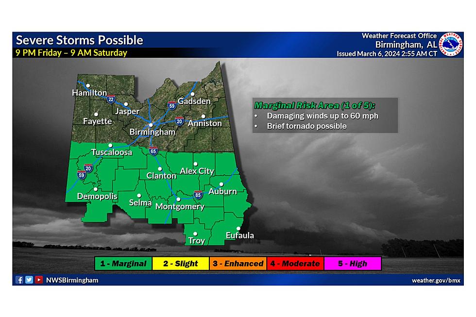
The Townsquare Media Tuscaloosa weather center is monitoring a system expected to bring widespread rain, raising concerns about heavy rainfall and localized flooding. Additionally, a few strong to severe storms may affect portions of our south-central counties.
Timing
The approaching weather system is expected to affect our area from Friday into Saturday morning. Anticipate widespread rain starting on Friday afternoon and continuing through Saturday morning, with the potential for severe weather from Friday evening into Saturday morning.
Impacted Areas
James Spann, ABC 33/40, and Townsquare Media Tuscaloosa Chief Meteorologist said that the “SPC has defined a "slight risk" (level 2/5) of severe thunderstorms for areas south of a line from York to Greenville to Dothan. A "marginal risk" (level 1/5) is in place as far north as Florence, Snead, and Ranburne.”
Threats
According to the National Weather Service in Birmingham, here are the main threats associated with this weather system.
- Flash Flooding
- River Flooding
- Generally, 2" to 4" of rainfall is possible, with isolated amounts up to 5" possible
- Damaging winds up to 60 mph
- A brief tornado will be possible

We will continue to monitor this system and provide necessary updates.
- Mary K – Weather Forecaster
Amazing and Intriguing Weather Folklore
Signs of a Bad Winter According to Weather Folklore
Gallery Credit: Mary K
Clouds: Artwork In The Sky
Sunrises from Around the World
KEEP READING: Get answers to 51 of the most frequently asked weather questions...
LOOK: The most extreme temperatures in the history of every state
Gallery Credit: Anuradha Varanasi
LOOK: The most expensive weather and climate disasters in recent decades
Gallery Credit: KATELYN LEBOFF


